Marine Infrastructure
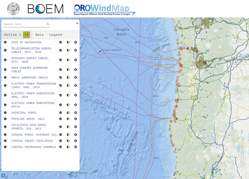
Infrastructure is a top-level category of data that represent the locations of permanent or temporary installations intended to support basic human activities or needs, including communication, transportation, shoreline protection, housing, recreation, and utilities. Data required for marine planning are limited to infrastructure that has effects on environmental processes or human activities that impact the coast, Great Lakes, or ocean.
View Data in the OROWindMap Tool

View Metadata
- Aids To Navigation, NOAA, 2019
- Coastal Maintained Navigational Channels, NOAA, 2018
- Coastal Energy Facilities, NOAA, 2017
- Electric Power Substations, HIFLD, 2017
- Electric Power Substations, ORNL, 2020
- Electric Power Transmission Lines, ORNL, 2019
- Facilities with NPDES Permits, EPA, 2019
- Coastal Ports, Ecotrust 2011
- Pipeline Areas, NOAA, 2018
- Research SubSea Cables, OFCC, 2020
- Telecommunication SubSea Cables, OFCC, 2020